The Most Beautiful Peaks of Divčibare – A Guide to Hiking Trails
We’d escape from Belgrade for a day or two to hike in nature and clear our lungs with some fresh mountain air. When we don’t feel like traveling far, the decision often falls on Povlen or Maljen. They belong to the Valjevo mountain range and are perhaps the closest mountains to Belgrade with noticeable elevation.
Maljen is the first in the series of Valjevo mountains and stretches east-west for about 25 kilometers. Like the neighboring Povlen, this mountain is perfect for those looking to improve their fitness and for anyone eager for hiking in nature.
Until the late 18th century, Povlen, Maljen, and Suvobor were collectively called Karadag (Turkish) or Black Mountain. In the 19th century, Maljen received its name, which is tied to the verb “pomaljati se” (to appear). This is a forested mountain, but it is still rich in clearings, meadows, and viewpoints. The highest peaks are Kraljev sto (1,104 m), Crni vrh (1,098 m), Stražara (1,061 m), Golubac (1,056 m), Paljba (1,051 m), Velika pleća (1,037 m), Veliko brdo (1,036 m), Vlasovi (1,033 m), and Zabalac (1,011 m).
Staying on Maljen is easier thanks to the presence of Divčibare.

Divčibare is a mountain field and a settlement at an altitude of 980 meters, extending from Crni vrh, Paljba, and Golubac to Kraljev sto and Veliko brdo. It is surrounded by peaks that protect it from winds while offering incredible views of the surroundings. Stražara divides Divčibare into two parts: Divčibare and Pitomine. This peak was named during the Austrian administration of northern Serbia from 1718 to 1739. It marked the boundary between Austria and the Ottoman Empire, with an Austrian border guard stationed there.
The name Divčibare is tied to the small river Crna Kamenica. According to local legends, the mountain field got its name from an old Slavic term meaning “maiden’s marshes.” This name comes from a story about a summer storm and the swollen waters of Crna Kamenica in which a young shepherdess drowned.
Today, Divčibare attracts visitors with its easy trails, the exploration of eight mountain peaks, and the sound of the very same Crna Kamenica. During the winter, Divčibare turns into a serious ski center.
We’ve visited Divčibare multiple times, and thanks to its proximity, we often go for a day trip or an entire weekend whenever we want to quickly escape the city. The hiking trails are well-marked, and the eight peaks surrounding Divčibare can be reached directly from the town center.
Peaks and Trails
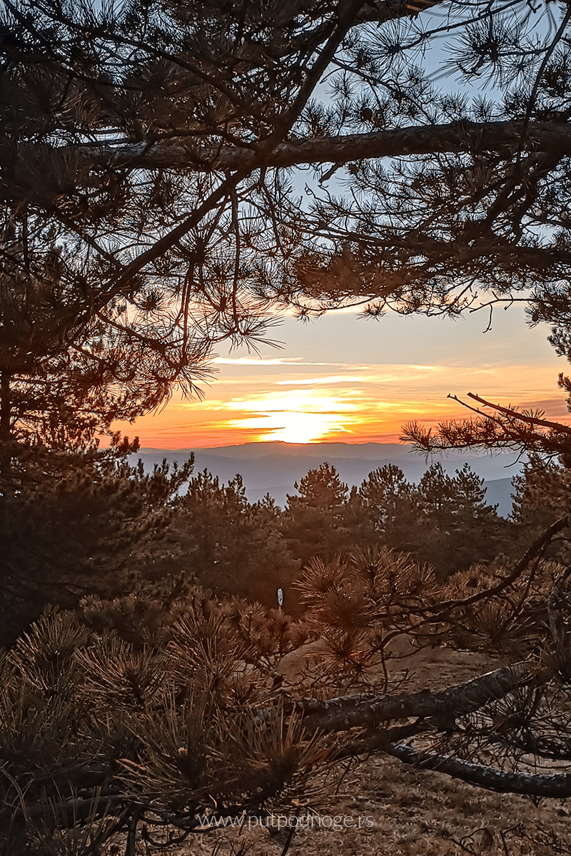
The most popular and certainly the most visited peak is Crni vrh at 1,098 meters, which rises above the settlement from the right bank of Crna Kamenica. It gets its name from its dark silhouette at dusk. The climb to the peak is not strenuous, and the trail is well-marked and passable. We’ve hiked this route countless times, in dry weather, heavy rain, and deep snow, so I can confidently say it won’t present a significant challenge.
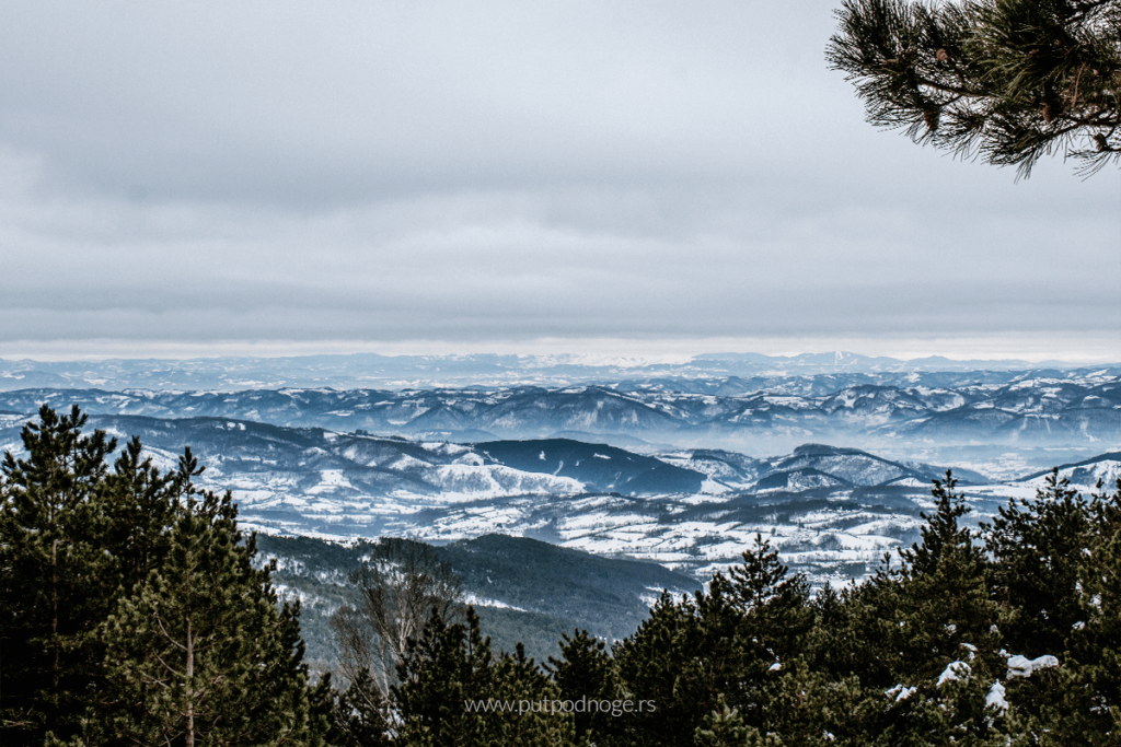
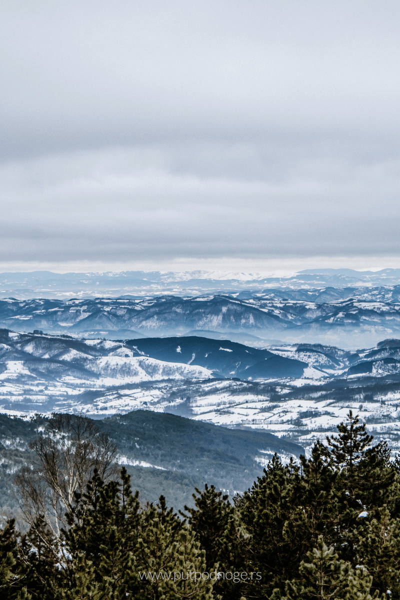
After the climb, you’re rewarded with a fantastic view. On clear days, you can see the outlines of Suvobor, Kablara, Ovčara, Zajčica, and Subjel. To the far west, you can spot the other Valjevo mountains: Povlen, Magleš, Jablanik, and Medvednik.
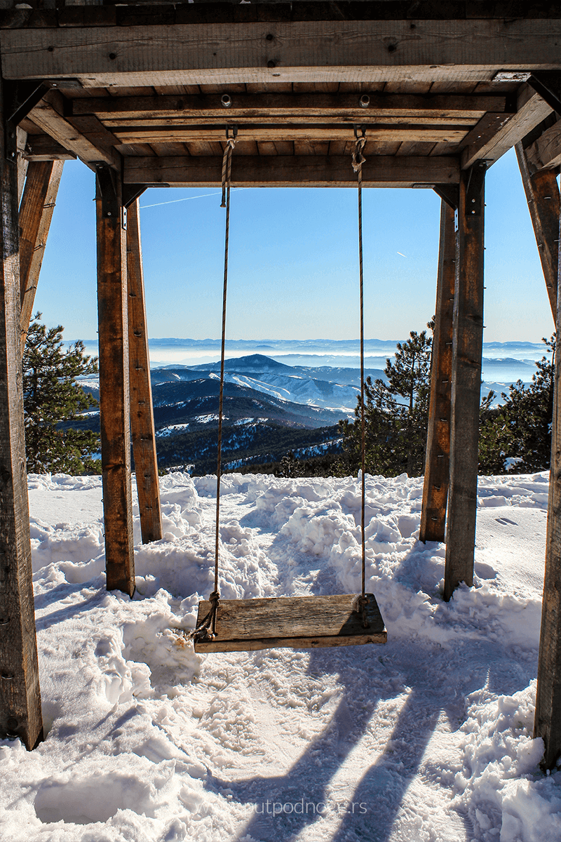
If you continue from Crni vrh toward the ski slope, you’ll encounter the famous “swing,” a wooden structure that offers an incredible panoramic view. Nearby is also the mentioned ski slope. This entire area is perfect for wandering and exploring, especially during the warmer months.
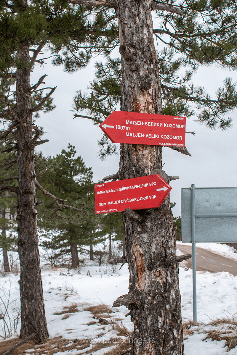
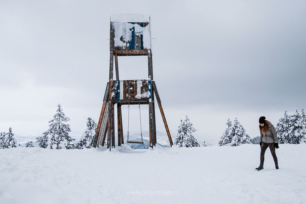
If you continue along the trail through the forest to the Velika pleća peak, you’ll enjoy a leisurely walk through the woods and a clearing with another wooden viewpoint. The walk from Crni vrh to Velika pleća won’t take long, and it’s not challenging at all.
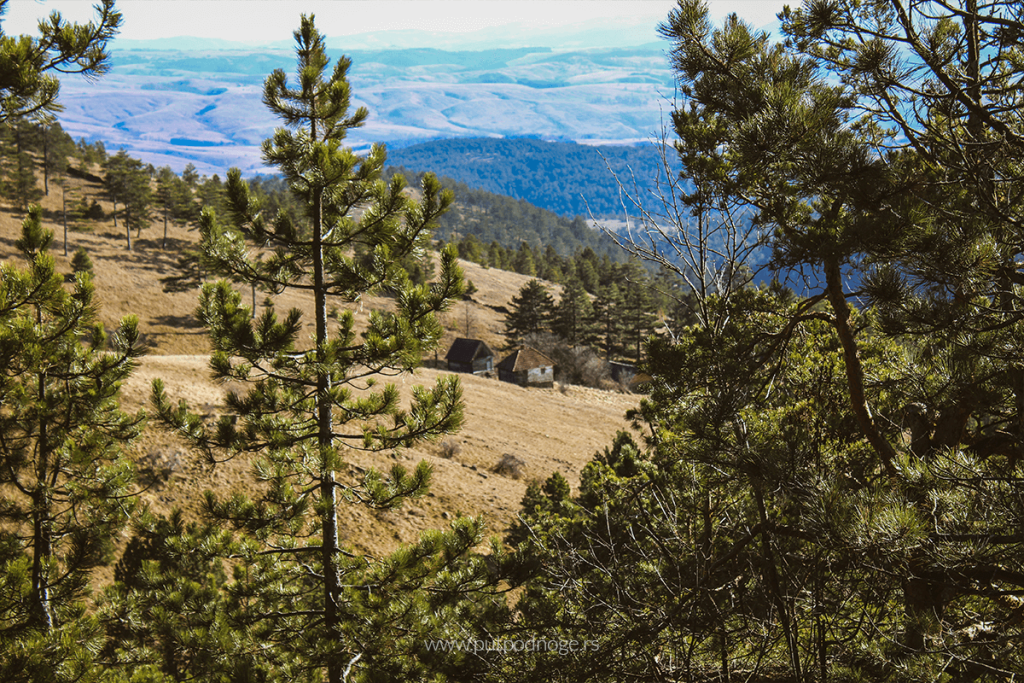
The view from this peak is just as impressive as the one from Crni vrh, and it feels as though you could wander this vast space all day. Below the peak, to the left, lies the wooded canyon of Crna Kamenica, while straight ahead, to the south, wide meadows of the Tometino polje plateau stretch out, with a road leading to Požega.
The trail then leads toward Kraljev sto, the highest peak of Maljen. It’s believed to be named after Emperor Dušan, and the story takes us back to the time before Dušan became emperor, when he fought a battle against the Hungarians in this area. On his return from Prizren, the two armies met at this very spot, and according to legends, Emperor Dušan observed the progress of the battle from this peak. To preserve the story of this event, the people named the peak Kraljev sto (King’s Table).
One of the most accessible viewpoints is Paljba at 1,051 meters, as it is located along the road leading to Valjevo. You can either take the trail through the forest or the paved road. Due to its easy accessibility, this peak is always crowded. From the top, you can see the villages of Skakavci, Rosići, Ražana, and Kosjerić in the valley below. The view is spectacular at dusk when the sun sets behind Medvednik and Povlen.
On the other side are Golubac, Stražara, and Ljuti krš, also accessible and just as impressive.

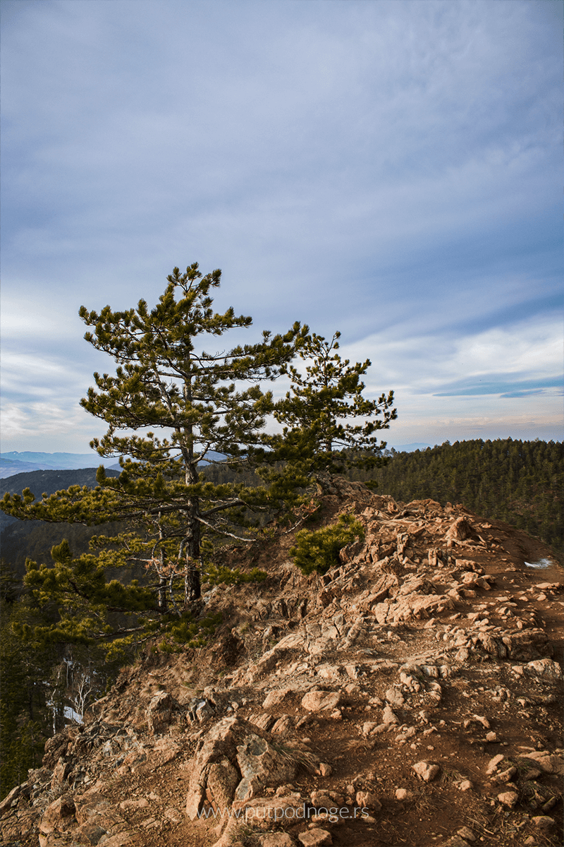
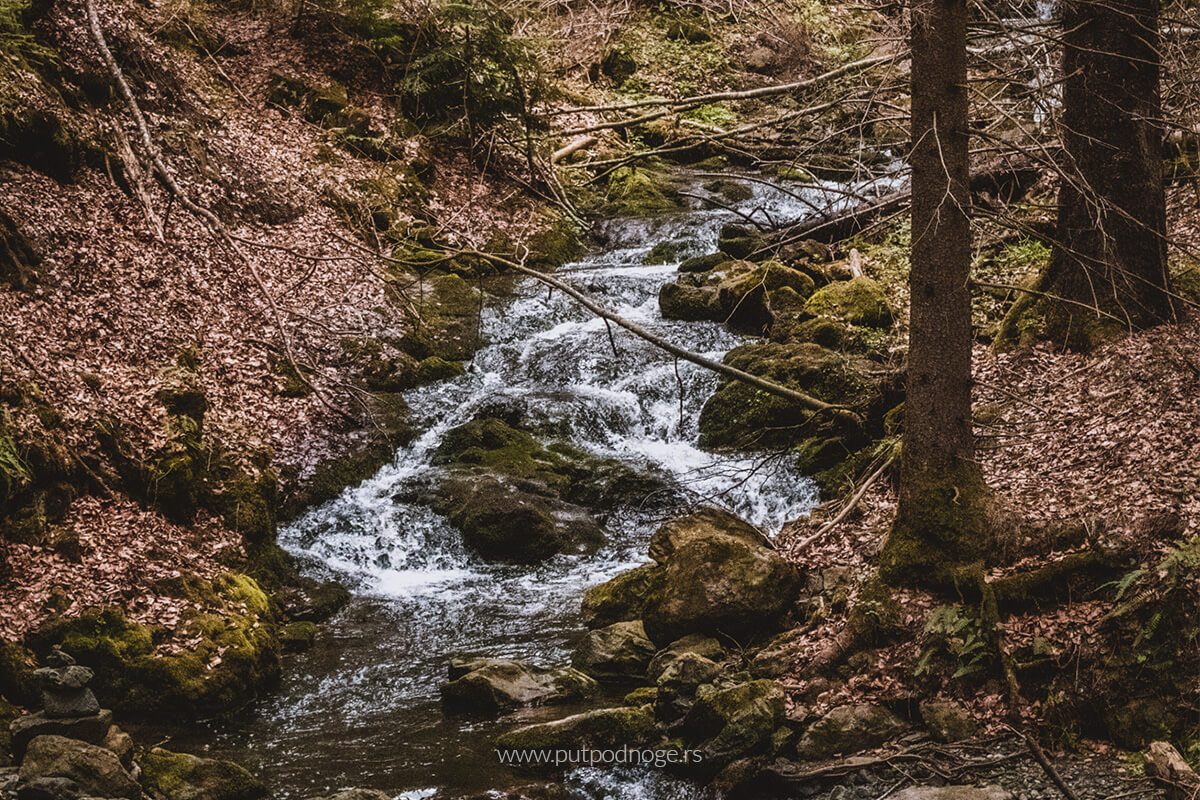
Ljuti krš is often considered the most beautiful, and I have to agree. The trail to the viewpoint goes through a coniferous forest interspersed with birches, and in the last 100-150 meters, it narrows, leading along the ridge. The viewpoint itself is located at 962 meters above sea level. The view is stunning: to the left, across the deep valley, you can see Golubac, and to the right, you can see Bačevački vis, Čubrica, and Pejar. Straight ahead is the view down the canyon of Crna Reka. You can descend to the river via the ridge, but it requires more attention, and it’s not recommended if you lack experience in such terrain. This is a strict nature reserve, Crna Reka – a category two reserve.
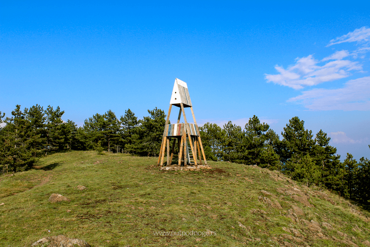
Golubac is no less captivating and is one of the easily accessible viewpoints from the town center. From Divčibare center, the trail leads to the right of the Church of St. Panteleimon, past the “Maljen” hotel, and near the “EPS” resort. Passing through the forest, the trail takes you across meadows, between weekend homes. After passing the homes, tall pines appear with a signpost: left for Paljba and slightly right for Golubac. From there, you reach an open area where Golubac is clearly visible. A gentle ascent takes you quickly to the peak, where there is a wooden observation post.
From Golubac, the view stretches westward, where you can see the Valjevo mountains: Povlen, Magleš, Jablanik, and Medvednik, and to the north, the distant Cer mountain. To the west, beneath Golubac, there is a wooded, deep valley of the Bukovska River, which we also visited. On the opposite side, to the east and south, the view extends to the highest Maljen peak, Kraljev sto, Velika pleća, Crni vrh, and Paljba, as well as the entire Divčibare plateau.
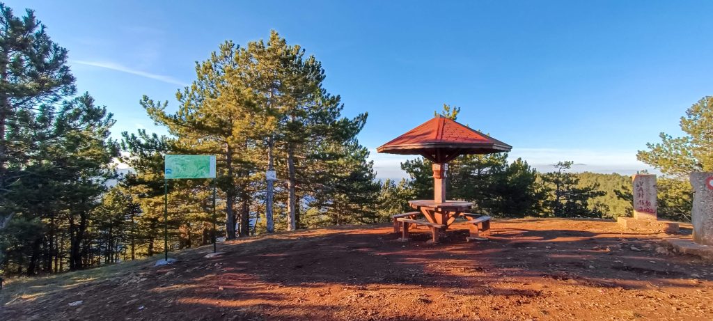
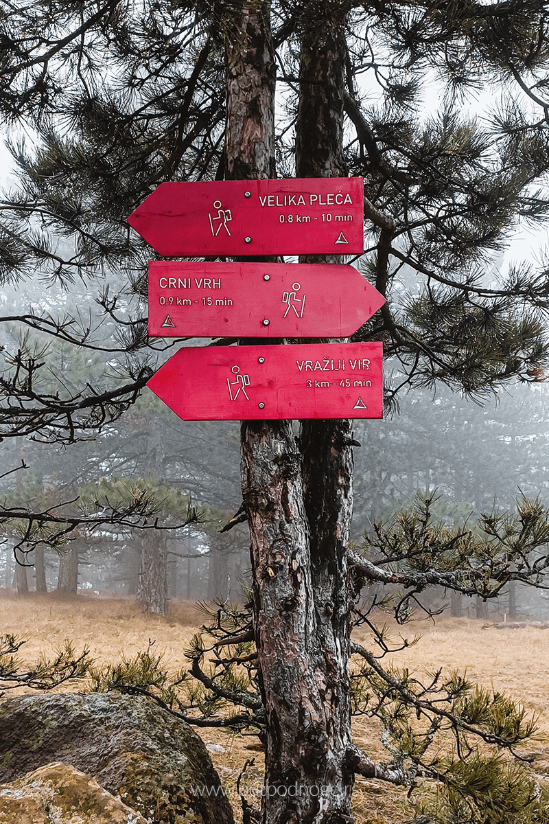
All of these trails are fairly easy and perfect for long walks in nature. They are classified as moderate trails, well-marked, and each signpost indicates approximately how much time you need to reach the next peak.
Ljuti krš – 30 minutes
Golubac – 30 minutes
Paljba Viewpoint – 30 minutes
Crni vrh – 30 minutes
Velika pleća – 40 minutes
Kraljev sto – 35 minutes
Pitomine – 10 minutes
Stražara – 10 minutes
Leave a Reply