Eastern Serbia – Blederija Waterfall
Every part of Serbia is unique in its own way and each has its own charm that lures me in. There is a place in Serbia where you can’t tell where dreams end and reality begins, what is true and what is myth. Eastern Serbia, cloaked in mystery, is an eternal source of inspiration.
Unusual sights of karst landscapes, inaccessible canyons, the largest underground halls in Serbia, waterfalls, the mighty Danube, and rugged stone cliffs — this is Eastern Serbia.
The noticeably shorter days will make our story even briefer, but the dry and sunny autumn won’t let me rest. Two days of travel lie ahead of us.
Đerdap and Miroč
One of the most beautiful roads in Serbia is the Danube highway. When you observe the Danube — so often taken for granted in Belgrade — you realize just how powerful it truly is as the second-largest river in Europe.
You can’t help but admire the vast blue expanse near Golubac, where the river stretches up to 7 kilometers wide, looking more like a sea than a river. Beyond the fortress towers, the gorge begins, where the Košava wind lashes through.
Everything here seems to live in extremes — seemingly gentle yet harsh at the same time.
We leave the Danube behind and head inland toward Miroč. Autumn has been kind to this mountain — colors, scents, and the sound of falling leaves are all around.
If only we had more time to linger here, but we must return to the Danube, reaching it again near Stara Brza Palanka. A bit further along the road from Brza Palanka toward Kladovo, a sign points toward the village of Reka and Blederija Waterfall, our first destination.
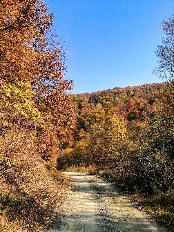
A narrow asphalt road leads through the village and between the houses — so narrow that two vehicles can’t pass each other. From the last house in the village, a dirt and gravel track continues. From the village to the waterfall is a little under 6 kilometers, and it’s possible to drive almost all the way, crossing two narrow wooden bridges.
We only drove about halfway and walked the remaining 3 kilometers.
Blederija Waterfall — A Hidden Gem of Eastern Serbia
They say it’s not easy to reach Blederija Waterfall, but that the effort is rewarded. And truly, it is.
It only takes a bit of effort and the old saying proves true — every real treasure requires a little struggle. And Blederija truly is a gem of this region.
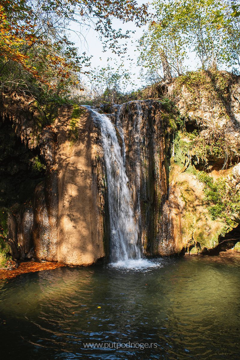
The waterfall is located in eastern Serbia, near the village of Reka, about 31 kilometers from Kladovo.
The Blederija River, after which the waterfall is named, springs at an altitude of 190 meters. Downstream, it merges with the Sokolovica and Suvaja tributaries, then flows into the Ravna River, which eventually leads to the Danube.
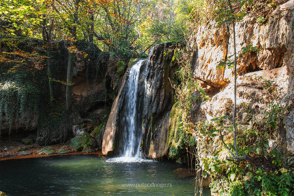
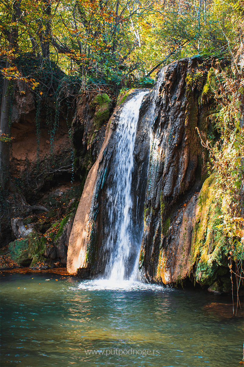
When you arrive, you’re met with a breathtaking sight.
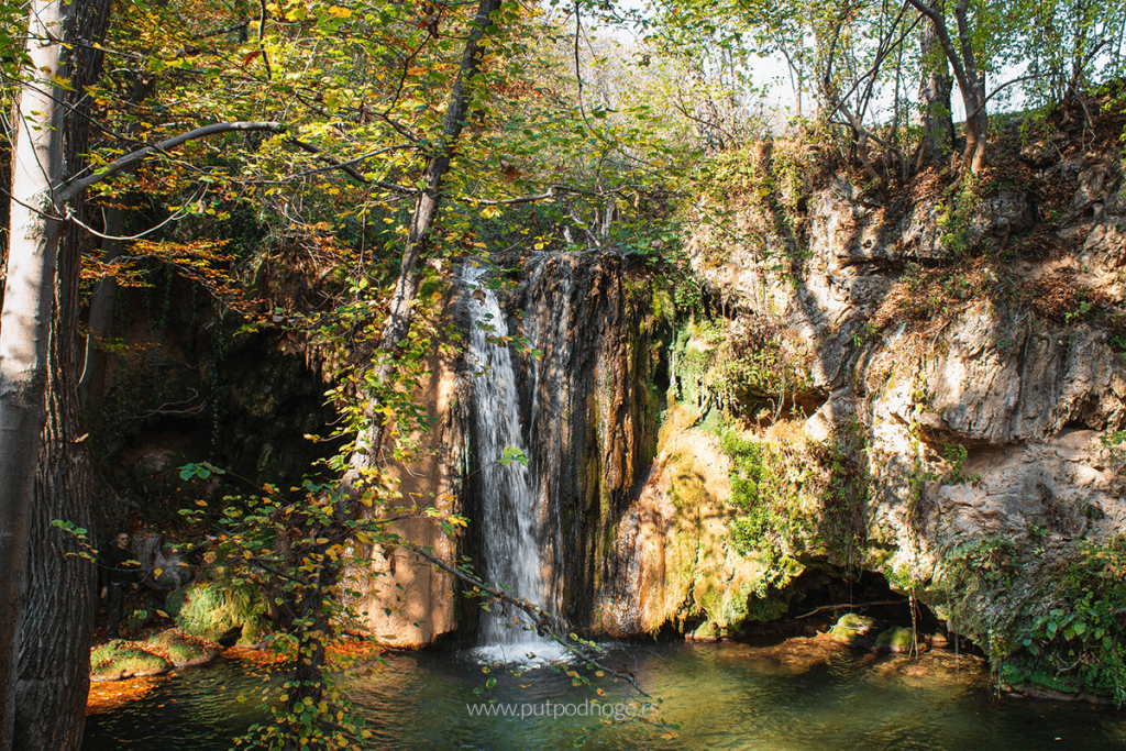
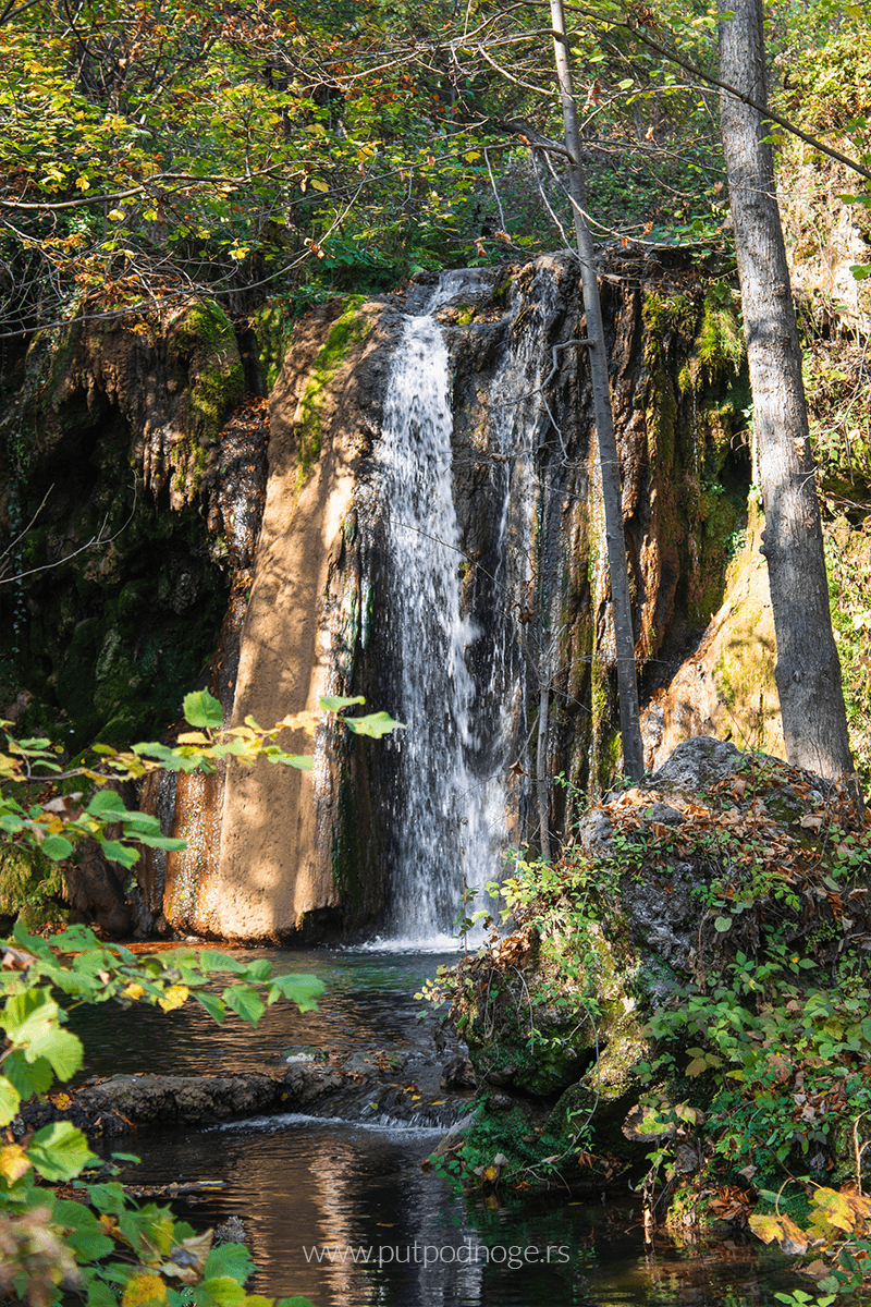
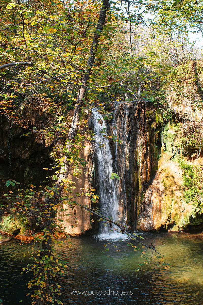
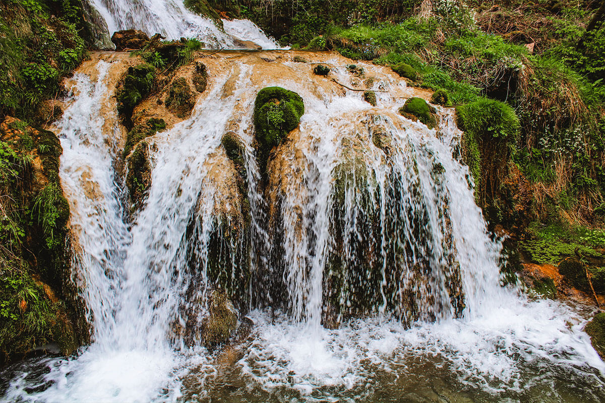
The water of Blederija cascades over a tufa barrier shaped like a horseshoe, falling from a height of about 7 meters into a turquoise lake surrounded by lush vegetation.
Since we visited Blederija in late October, during autumn, the water level was somewhat lower, but it didn’t diminish the beauty of the scene at all.
On the contrary, the emerald shades of the water and the peacefulness of nature made the entire setting look even more magical.
The whole complex consists of:
- the karst spring of the Blederija River with three sources (one of them subthermal, at around 17°C),
- two waterfalls (one larger and one smaller, though the smaller one can dry up during summer),
- a tufa accumulation (a small turquoise lake),
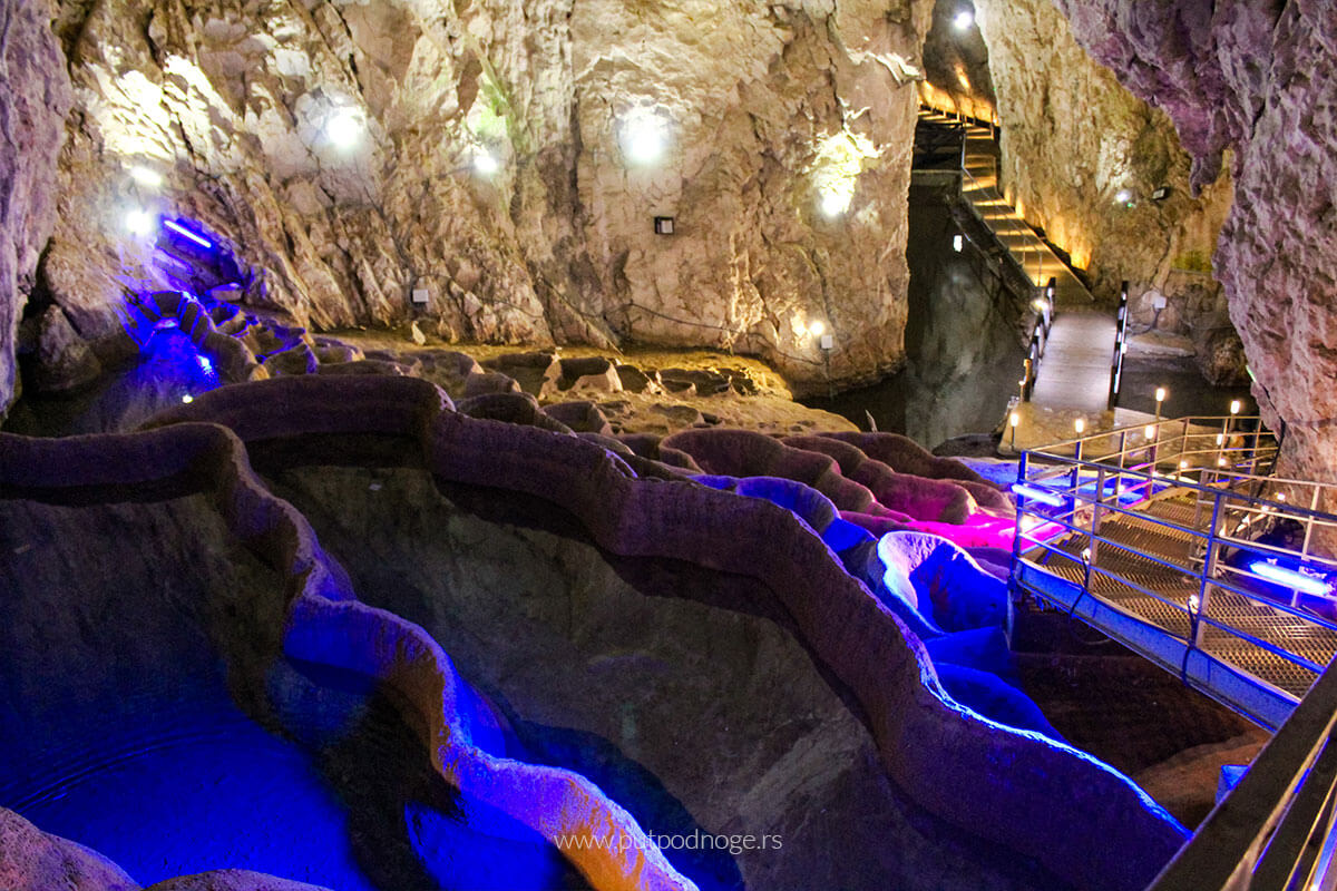
- Sokolovica Cave,
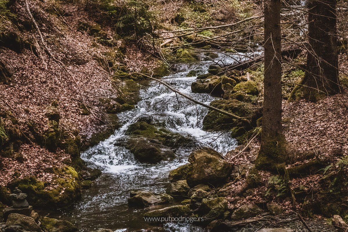
- and the river course of Blederija itself.
To the left of the main waterfall, there’s a sign pointing toward Sokolovica Cave. The trail follows the river and takes about 30–40 minutes of easy walking (around 2.5–3 kilometers).
Closer to the cave, the path becomes a bit steeper, so it’s best to wear sturdy shoes and bring headlamps if you plan to enter and explore.
The waterfall is accessible year-round, but visits in spring and autumn offer the best experience due to higher water levels and the colors of nature.
The temperature of the lake water is low — around 14°C — and on hot summer days it may seem like a tempting refreshment. However, please, no matter how inviting it looks, do not swim in the lake. Swimming disrupts this fragile ecosystem and damages the tufa formations. Admire the beauty from the shore so that future generations can also enjoy it.
If you’re looking to swim, the beach at Brza Palanka nearby is a great option during the warmer months.
Visiting Blederija Waterfall was truly one of the highlights of our weekend trip through Eastern Serbia.
Although the days were short and autumn was well into its golden phase, we managed to enjoy the silence, the nature, and the breathtaking scene that instantly captures the heart.
Blederija Waterfall is truly one of those places that is hard to find, but impossible to forget.
How to get to Blederija waterfall
From Belgrade, it takes about 4 to 4.5 hours by car (about 250 kilometers).
The route goes along the Belgrade–Niš highway to Požarevac, then towards Golubac and Donji Milanovac along the Đerdap highway.
Along the way, you can visit Lepenski Vir and Golubac Fortress.
After Donji Milanovac, turn towards the village of Miroč (using GPS navigation), which shortens the trip toward Brza Palanka.
From Brza Palanka, follow the signs to the village of Reka.
Once you enter Reka, drive along the asphalt road to the end (about 4 kilometers), crossing two wooden bridges. At the second bridge, turn right following the sign for the waterfall.
There, you can park your car and continue on foot.
A wide dirt road leads to the waterfall, with no significant elevation, making it easy for a relaxed walk and suitable even for less experienced hikers.
The trail is well marked and takes about 15 to 30 minutes of light walking.
Leave a Reply